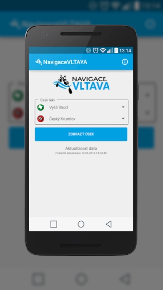
About Navigace VLTAVA
Going down the river Vltava and missing details of any points on the river? You want to know where you are on the river, and what do you expect? Navigation VLTAVA was created by the Association of boat rentals and...
Going down the river Vltava and missing details of any points on the river? You want to know where you are on the river, and what do you expect?
Navigation VLTAVA was created by the Association of boat rentals and campsites on the Vltava. Rentals and campsites association concerned by this application wishing to contribute to simplifying the orientation of boaters on the river itself, improve the safety and quality of services on the river and around it. At the same time the application is an appropriate means to plan a trip on the Vltava river to your liking. The application is unique in that it can be attributed to the actual rental and camping and come into accurate and timely data.
The fundamental features of the application:
- Totally free without any hidden charges, and even in the future
- Without ads (development and maintenance of the finances of the Association boat rentals and campsites on the Vltava)
- Completely off-line (only the map portion may require internet connection)
What you will find in the application?
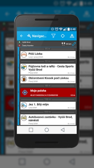
- A detailed mileage across the river
- Trauma points - the points of the Integrated Rescue System (IRS)
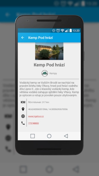
- A complete, updated information about places on the Vltava River
- GPS navigation on the river with determining your position against all the points and places on the river Vltava
- Detailed classification of all points
What information can be found in the application?
The application is developed based on the requirements directly from watermen will be complemented by people, "the river" and therefore selecting points on the river was a big emphasis.
Here you will find safety information in the form of trauma points, important information for rafting (entrance and exit points, list of rental, dams, bridges, pedestrian walkways), information about hotels and restaurants (camps, snacks for watermen, restaurants), about the possible traffic and near the river (canoeing buses, buses, trains, towns and villages around the river and sights).
Websites navigacevltava.cz
On our website is still widespread information about the possibility of sorting the various points on the river, according to specific parameters and equipment, or to plan your trip from home to the place on the river.
Previous Versions
Here you can find the changelog of Navigace VLTAVA since it was posted on our website on 2023-03-05 14:27:07.
The latest version is 1.9 and it was updated on 2024-04-19 21:55:21. See below the changes in each version.
Navigace VLTAVA version 1.9
Updated At: 2017-08-17
Changes: Aktualizace veškerých bodu na řece, doplnění fotografií, aktualizované zastávky vodáckého autobusu, optimalizace aktualizačních dat, zpřesněno určení polohy na řece.
Disclaimer
Official Google Play Link
We do not host Navigace VLTAVA on our servers. We did not scan it for viruses, adware, spyware or other type of malware. This app is hosted by Google and passed their terms and conditions to be listed there. We recommend caution when installing it.
The Google Play link for Navigace VLTAVA is provided to you by apps112.com without any warranties, representations or guarantees of any kind, so access it at your own risk.
If you have questions regarding this particular app contact the publisher directly. For questions about the functionalities of apps112.com contact us.